Lytham St.Annes Coat of Arms

 
amounderness.co.uk
Lytham St.Annes, Lancashire, England


Lytham Old Ordnance Survey Map 1908

Lytham
Ordnance Survey Map 1908

Sheet 67.02; intro by Martin Ramsbottom

Map
Publisher: Alan Godfrey Maps; Facsimile of 1908 edition
(Jul 1997)
ISBN-10: 0850549019
ISBN-13: 978-0850549010
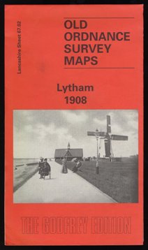
 

Lytham Old Ordnance Survey Map 1908

 This detailed map is double-sided to give maximum coverage, and so covers most of the town. The main map covers the western part of the town, with coverage stretching from Agnew Street and Beach Street westward towards Ansdel, incl St Paul's church. Features include Marine Lake, Ansdell goods station, Fairhaven Hotel, St Cuthbert's church, Lowther Gardens.

On the reverse we include a large part of adjacent sheet 67.03 covering Lytham town centre. Features here include railway with station and goods station, pier, Market Square, tramways and tram shed, windmill, Assembly Rooms, cottage hospital, Albert Hall. A shipbuilding yard on the Liggard Brook is in the NE corner.

The map links up with sheets 59.13 St Annes to the west and 59.14 Lytham Hall to the north.

 The Alan Godfrey Series of Old Ordnance Survey Maps.

Fleetwood Old Ordnance Survey Map 1910 (published 1996)
Rossall near Fleetwood Old Ordnance Survey Map 1909 (published 2006)
Thornton Cleveleys Old Ordnance Survey Map 1910 (published 2005)
Poulton le Fylde Old Ordnance Survey Map 1910 (published 1989)
Bispham and Norbreck Old Ordnance Survey Map 1909 (published 2009)
Blackpool North Shore Old Ordnance Survey Map 1910-1938 (published 2006)
Blackpool (North Pier & Town Centre) Old Ordnance Survey Map 1910 (published 2006)
Blackpool North Pier & Town Centre Old Ordnance Survey Map 1932 OUT OF PRINT (published 1988)
Blackpool Central Pier area Old Ordnance Survey Map 1909 (published 2006)
Blackpool South Old Ordnance Survey Map 1909 (published 1999)
St Annes-on the-Sea Old Ordnance Survey Map 1909 (published 1998)
Lytham Old Ordnance Survey Map 1908 (published 1997)
Lytham Hall Park Old Ordnance Survey Map 1908 (published 1998)


   Back to top     |      Print this page   |     Bookmark this page