|
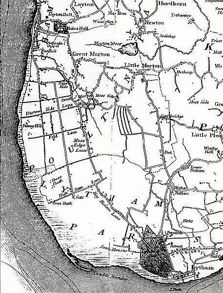 The Hawes was a vast swathe of common land between the Manors of Layton (modern Blackpool) and Lytham. It
was used by the tenants of the two villages. The Hawes was a vast swathe of common land between the Manors of Layton (modern Blackpool) and Lytham. It
was used by the tenants of the two villages.
The Hawes stretched around the coast from Lytham to Blackpool (near Manchester
Square) where Marton Mere emptied into the Black Poole on the shore. The Hawes extended inland as
Hawes Side Lane & Common Edge Road in Blackpool.
The boundary between Layton Hawes and Lytham Hawes was disputed for many years but was set in the
1500s at Division Lane (boundary of Blackpool Airport) near Cross Slack.
Lytham Hawes was common land used by the tenants until the Clifton Family enclosed it under an Act of 1616. Over the years they converted most of Lytham Hawes into
farmland and leased it to tenant farmers.
The amount of common land was reduced to roughly that bounded by modern Worsley Road, Ansdell,
Church Road, St.Annes and Blackpool Airport.
The hamlet which developed at the Lytham end of the common was named Common Side
and is marked on this map as South Houses.
Layton Hawes in Blackpool was enclosed under an Act of 1767 and as can be seen
on the map, roads (now Lytham Road, St.Annes Road & Harrowside), farms & cottages were
built and between them were fields.
|
